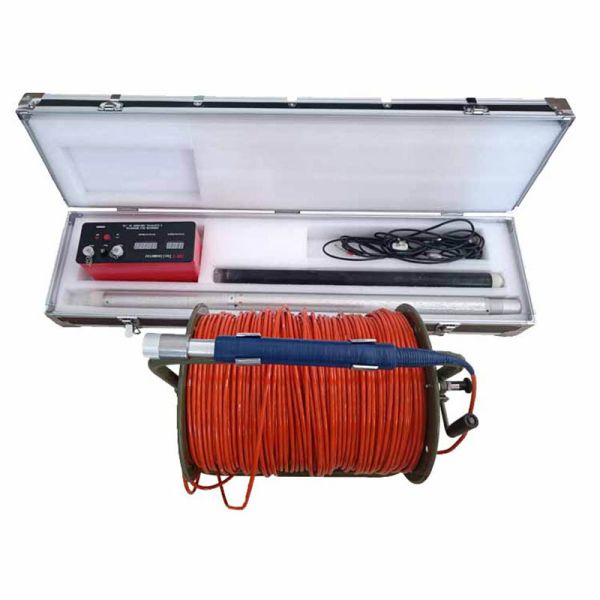
Product Description:
Overall, the Portable Digital Inclinometer is a must-have tool for
engineers and geologists who are tasked with drilling boreholes and
need to measure their deviation. Its compact and portable design,
combined with its state-of-the-art features, make it an ideal
solution for anyone who needs to measure borehole deviation
accurately and reliably.
 One of the standout features of the Portable Digital Inclinometer
is its Azimuth accuracy, which ranges from 0~360°. This feature
provides users with an accurate reading of the deviation angle of
the borehole, allowing for precise measurements. The device also
has a working temperature range of 0~85°C, which makes it suitable
for use in a variety of environments.
One of the standout features of the Portable Digital Inclinometer
is its Azimuth accuracy, which ranges from 0~360°. This feature
provides users with an accurate reading of the deviation angle of
the borehole, allowing for precise measurements. The device also
has a working temperature range of 0~85°C, which makes it suitable
for use in a variety of environments.
 The Portable Digital Inclinometer is equipped with a Vertex
Accuracy of ≤0.1°, ensuring that the device is capable of
delivering accurate readings even in the most challenging
conditions. This feature makes the device highly reliable and
ensures that it provides consistent and accurate readings for long
periods of time.
The Portable Digital Inclinometer is equipped with a Vertex
Accuracy of ≤0.1°, ensuring that the device is capable of
delivering accurate readings even in the most challenging
conditions. This feature makes the device highly reliable and
ensures that it provides consistent and accurate readings for long
periods of time.
Features:
- Digital Accuracy: Equipped with high-precision sensors, our Portable Digital
Inclinometer provides accurate measurements of slope angles with
minimal margin of error, ensuring reliable data for critical slope
stability assessments.
- Compact and Lightweight:Designed for portability and ease of use, this inclinometer is
compact and lightweight, making it convenient to carry to various
job sites without compromising on performance.
- Easy-to-Read Display:The digital display screen presents slope angle readings in a clear
and user-friendly manner, allowing for quick and efficient
interpretation of data for real-time decision-making.
- Multiple Measurement Modes:With versatile measurement modes, including single-axis and
dual-axis inclinometer functions, this tool offers flexibility to
suit a wide range of slope monitoring and leveling applications.
- Data Logging and Transfer:The inclinometer is equipped with data logging capabilities,
enabling users to store and transfer measurement data for further
analysis or reporting, enhancing efficiency in data management.
- Durable Construction:Built to withstand rugged field conditions, our Portable Digital
Inclinometer is constructed with durability in mind, ensuring
reliability and longevity in all types of environments.
Technical Parameters:
| Product Name: | Portable Digital Inclinometer |
| Azimuth Accuracy: | 0~360° |
| Dimensions: | Ø42mm×980mm |
| Working Temperature: | 0~85°C |
| Vertex Accuracy: | ≤0.1° |
| Vertex Range: | 0 - 60° |
| Warranty: | 1 Year |
| Pressure: | 5Mpa |
| Depth: | 2000m |
Applications:
The borehole tiltmeter can be used in a variety of scenarios,
including geological exploration, mine surveying, tunnel
construction, and structural monitoring. It can be used to measure
the inclination and azimuth of boreholes, as well as the vertical
and horizontal displacement of structures.
The borehole tilt indicator is particularly useful in geological
exploration applications. It can be used to measure the dip and
strike of geological formations, as well as the orientation of
faults and joints. This information can be used to create
geological maps and models, which can be used to guide mineral
exploration and resource development.


